Technological support

One of the main criteria for the effective and comprehensive development of mineral resources is the reliability, efficiency and accessibility of geological information. Rapid access to information resources ensures the correctness and timeliness of management decisions, both by government agencies and subsoil user enterprises. The first GBDN subsystems were created in 1996 -1997. The purpose of this bank was to collect, store and systematize data on subsoil and subsoil use. In the GBDN subsystems, work is underway to maintain balance sheets and cadastres of deposits, collect information on licenses and contracts.
Interactive map
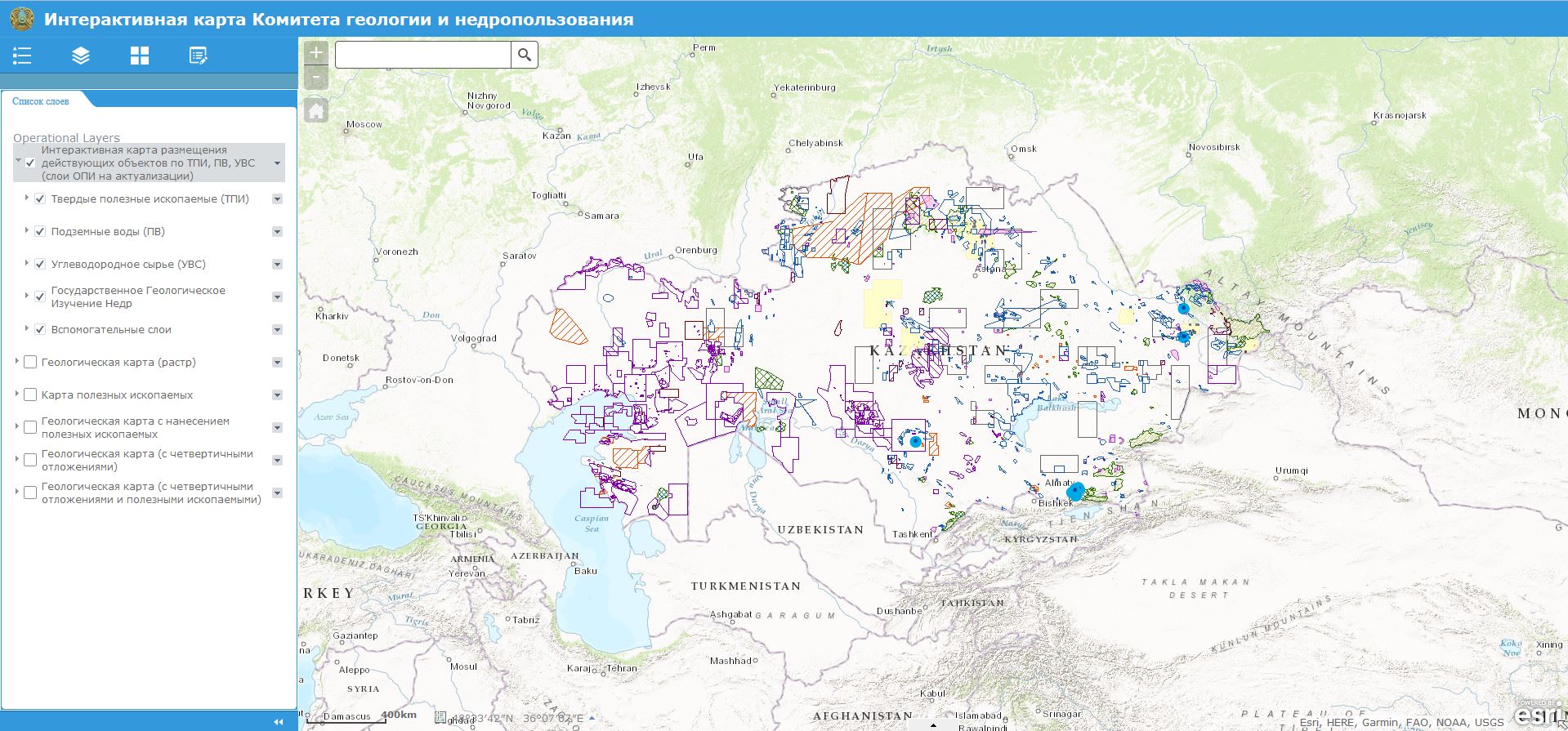
One of the most important areas of work to ensure the availability of geological information is the creation of an “Interactive map of the location of existing subsoil use objects of the Republic of Kazakhstan”, developed in 2014 within the framework of a memorandum of mutual cooperation between RCGI Kazgeoinform LLP and Kazzinc LLP.
For each site there is data that includes the contract number, type of activity, type of mineral, data on the subsoil user, as well as its details. There are also working layers “State geological study of subsoil”, “Specially protected natural areas”.
A Geological map layer has been developed and placed in a raster format of 200,000 scale, published at the All-Russian Research Geological Institute named after. A. P. Karpinsky (VSEGEI). At the same time, there is a division according to the territorial affiliation of interregional departments.
In accordance with the Law “On Subsoil and Subsoil Use,” the granting of the right to subsoil use to conduct exploration operations on subsoil plots provided under a simplified procedure is carried out by concluding a contract without a competition based on direct negotiations.
For reference: The interactive map is not the basis for concluding all types of contracts.
Knowledge
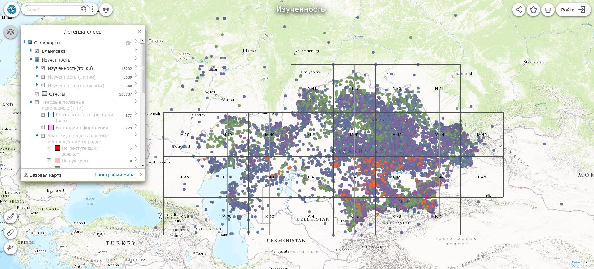
Visualization of more than 10,000 contours of exploration of the territory of the Republic of Kazakhstan was carried out, which is integrated with the “Electronic Card Index of Geological Reports” .
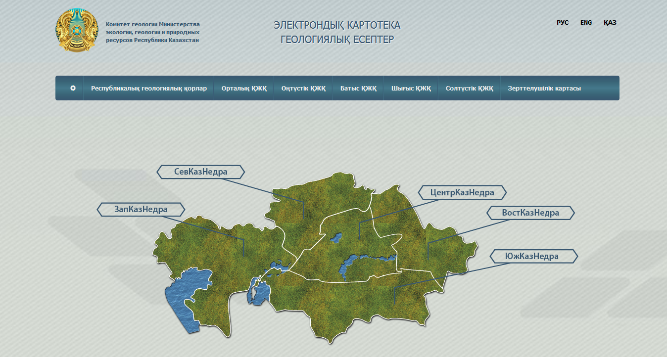
Electronic card file of geological reports
An updated version of the “Electronic Card Index of Geological Reports” has been posted on the website of the Committee of Geology.
This file contains information about geological reports available in the Republican Geological Fund. Online access to report metadata is provided (Inventory number, author, report title, year, brief description of the report).